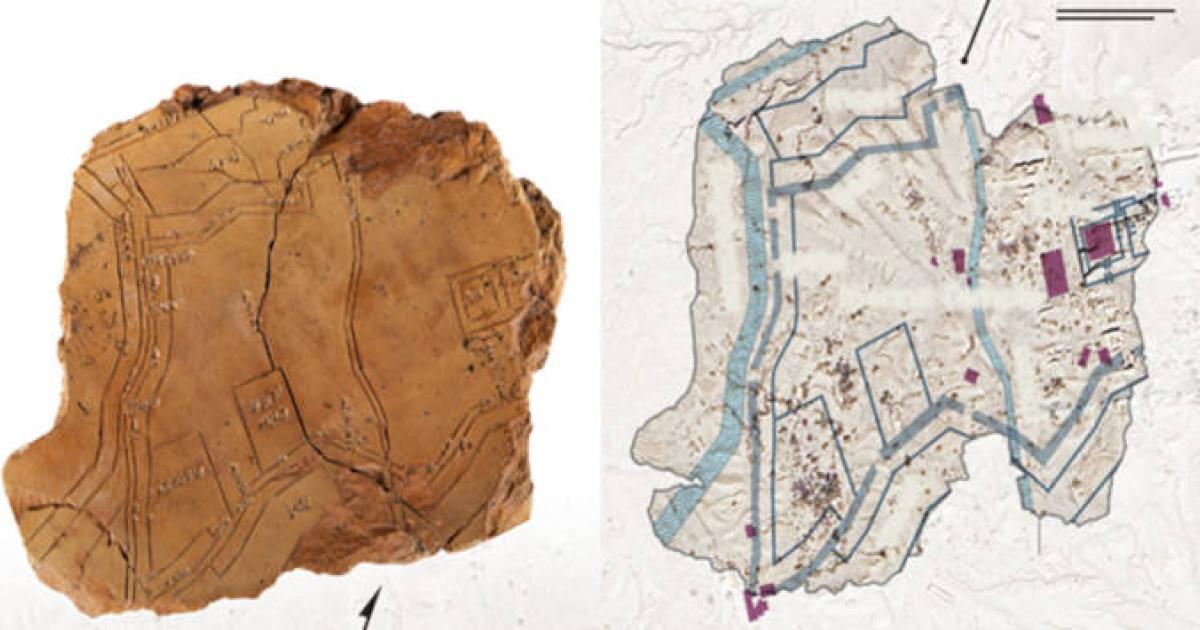
Debated. The tablet is a real map of Nippur, but it has not been proved to be the world's first city plan.
The map is a clay tablet about the size of a hand, from Nippur in Iraq. It was made between 1500 and 1300 BC, about 3,500 years ago. It shows the city, including gates in the wall, and it matches the ruins to within about 10 per cent. For many years, experts thought the lines were in the wrong places. Later, photos from the air and new digging showed walls where the map said they jutted south. The tablet also carries wedge-shaped writing.
No one knows who made the map or every job it had, and a plan for rebuilding the city is only an idea.
https://www.ancient-origins.net/news-history-archaeology/nippur-urban-planning-map-00102333